1
/
of
1
W&P
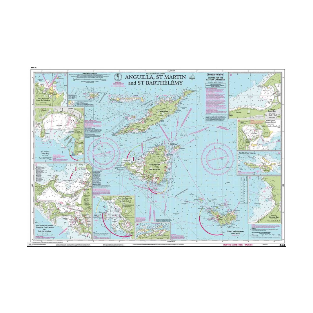
I-I A24 Anguilla, St Martin and St Barthelemy chart by Imray-Iolaire
I-I A24 Anguilla, St Martin and St Barthelemy chart by Imray-Iolaire
Regular Price
$32.00
Regular Price
Sale Price
$32.00
Unit Price
/
per
Tax included.
Shipping calculated at checkout.
Couldn't load pickup availability
This Imray-Iolaire water resistant chart features the islands of Anguilla, St. Martin and St. Barthelemy, three of the Leeward Islands in the Caribbean Sea. It includes large scale insets of Road Bay, Oyster Pond, Gustavia, Prickly Pear Cays, Crocus Bay, Shoal Bay and Island Harbor, Groot Baai, Simsonbaai, and Anse de Marigot. This chart is printed in color and uses official surveys and notes based on local knowledge. This Imray-Iolaire passage chart for the Eastern Caribbean is printed in color on treated water-resistant paper.

Have a question about a product or destination?
Call on us for 40 years experience in charts, navigation, and maritime history.
Call +1-267-773-7858 or Email sales@pilothousecharts.com