
W&P
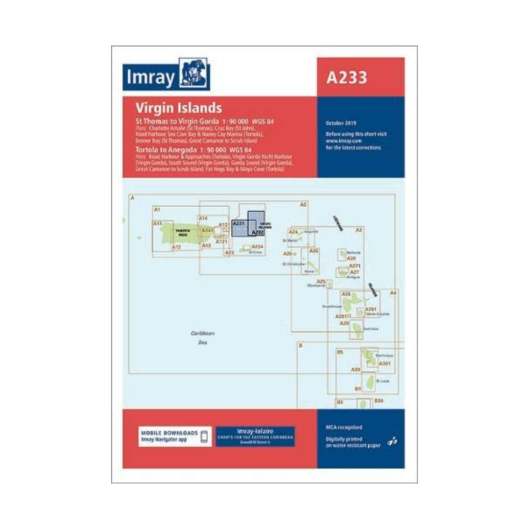
I-I A233 Virgin Islands chart by Imray-Iolaire -combines A231 & A232
I-I A233 Virgin Islands chart by Imray-Iolaire -combines A231 & A232
Couldn't load pickup availability
PLEASE NOTE: NO LONGER 1 SHEET PRINTED BOTH SIDES. THIS PACKAGE IS NOW 2 SEPARATE SHEETS (A231/A232)
This package includes an Imray-Iolaire water resistant chart of the Virgin Islands which features passage from St. Thomas to Virgin Gorda (A231 chart) and includes large-scale insets of Charlotte Amalie, Virgin Gorda Yacht Harbor, Roadtown Harbor, Sea Cow Bay and Nanny Cay Marina, and Cruz Bay. Also included is Imray-Tortola to Anegada (A232 chart) which features large-scale insets of Gorda Sound, South Sound, Roadtown Harbor and approaches, and Virgin Gorda Yacht Harbor. These charts are printed in color and use official surveys and notes based on local knowledge.
- Printed in color on treated, water-resistant paper
- Folded for efficient storage
- Includes protective plastic sleeve
Have a question about a product or destination?
Call on us for 40 years experience in charts, navigation, and maritime history.
Call +1-267-773-7858 or Email sales@pilothousecharts.com