NP
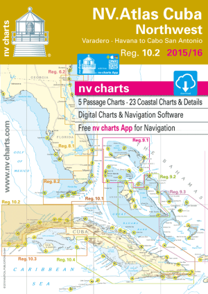
NV Charts Region 10.2 Cuba Northwest, Varadero, Habanna to Cabo San Antonio, 2015/16 Edition
NV Charts Region 10.2 Cuba Northwest, Varadero, Habanna to Cabo San Antonio, 2015/16 Edition
Couldn't load pickup availability
An atlas that covers the north coast of Cuba from Varadero and Havana to Cabo San Antonio.About 23" x 16" spiral-bound, in a heavy-duty plastic envelope.6 passage charts, 10 coastal charts, 18 detail charts.
The nv-charts are characterized by fine contours and easy to distinguish color graduations of the depth lines – turquoise for coral reefs, red for the 2-meter-line and blue for the 5-m-areas. Presented in a handy, user friendly size, (23½’’ x 16 ½’’) a thick plastic envelope protects the charts, enabling them to be easily stored.
The importance of good graphical representation of the topography when sailing in the Caribbean is essential. Well marked rivers, towns and street plans all help to give a clear overall view of the shoreside facilities of the islands.
Red numbered waypoints with coordinates based on WGS 84 enable yachtsmen to navigate using their GPS instruments. Heights and depths are given in the internationally accepted format of meters. Large scale approaches and land contour markings simplify the entrance into anchorages.

Have a question about a product or destination?
Call on us for 40 years experience in charts, navigation, and maritime history.
Call +1-267-773-7858 or Email sales@pilothousecharts.com