Skip to product information
1 of 1

MTP

Upper Chesapeake Bay Waterproof Chartbook by Maptech WPB0430-02

Upper Chesapeake Bay Waterproof Chartbook by Maptech WPB0430-02

Regular Price $67.95
Regular Price $79.95 Sale Price $67.95
Sale Sold Out
Tax included. Shipping calculated at checkout.

Upper Chesapeake Bay 2E

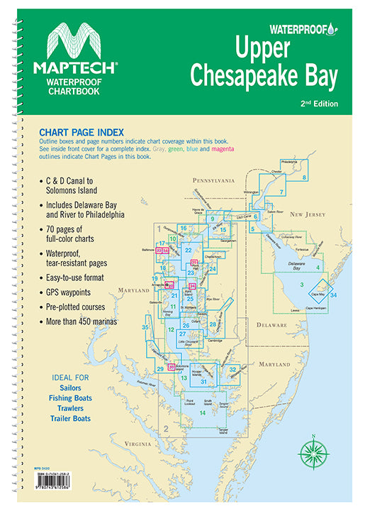
Covers C&D Canal to Solomons Island and includes Delaware Bay and River to Philadelphia. Offers full-color charts on waterproof, tear-resistant pages. Easy-to-use format includes GPS waypoints, pre-plotted courses and more than 350 marinas. 70 chart pages.

View full details

Have a question about a product or destination?

Call on us for 40 years experience in charts, navigation, and maritime history.

Call +1-267-773-7858 or Email sales@pilothousecharts.com